In a GIS, the ability to handle more data formats is of key
priority while developing the system. This gives the GIS users a wider variety of
formats to choose from during their analysis. QGIS has implemented this by
allowing users to add data from many sources and in many formats.
Loading a WMS, WFS or a WCS is one of the vital abilities
for users carrying out web mapping operations with their data. The three
formats of data can be loaded easily directly from GeoServer into QGIS.
First we need to establish a secure connection between QGIS
and GeoServer.
Load the WMS/WMTS dialog window at Layers >> Add
WMS/WMTS Layer on the Menu (QGIS) or by selecting the Add WMS/WMTS layer from
the Manage layers toolbar.

Give the connection a name. Example “mytest”
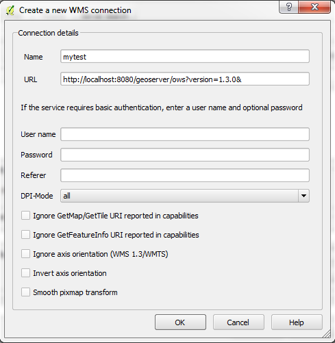
We need a URL to connect to our GeoServer. Here are the
steps:
Load GeoServer in a browser. In my case at http://localhost:8080/geoserver/web/
Use the default login credentials for GeoServer. Username: admin,
Password: geoserver
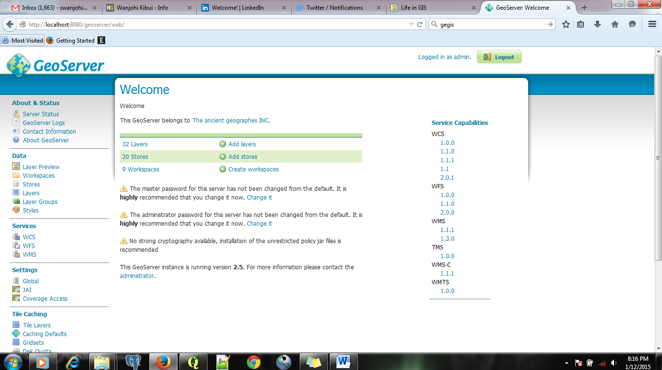
On the left column “Service Capabilities” select 1.3.0 under
WMS.A new page will be loaded.

Copy the URL of the loaded page and paste it
under the URL section in our “New” window and click OK.
Click on the “connect” button to load the layers from
GeoServer.

Click to select the layer of interest and click on “Add” and then “Close”.
The layer will be loaded in the QGIS application.

We just loaded a layer into QGIS directly from GeoServer.
For WFS and WCS the procedure is the same except that you
have to remember to select the appropriate option required e.g. WFS instead of
WMS.